This is one of the first questions people ask when they're looking at drone services for their project. And it's the right question — because frequency is directly tied to how much value you actually get out of it.
The honest answer is that it depends on what's happening on the ground. But there's a principle that applies to every phase of every project: once a phase of work is covered up, graded over, or built on top of, that data is gone. You can't go back and document it later. That's the single most important thing to understand when you're deciding how often to fly.
The Phase-by-Phase Breakdown
Different phases of a construction project move at different speeds and carry different risks. Here's how to think about frequency based on where your project actually is right now.
| Project Phase | Frequency | Why It Matters |
|---|---|---|
| Site Prep & Grading | Weekly | Dirt moves fast. Weekly flights let you track cut-and-fill, verify volumes, and catch grade issues before they compound into expensive corrections. |
| Underground Utilities | Before Each Backfill | Once it's buried it's gone. A flight before backfill creates a permanent record of exactly where every line and pipe sits — invaluable five years from now. |
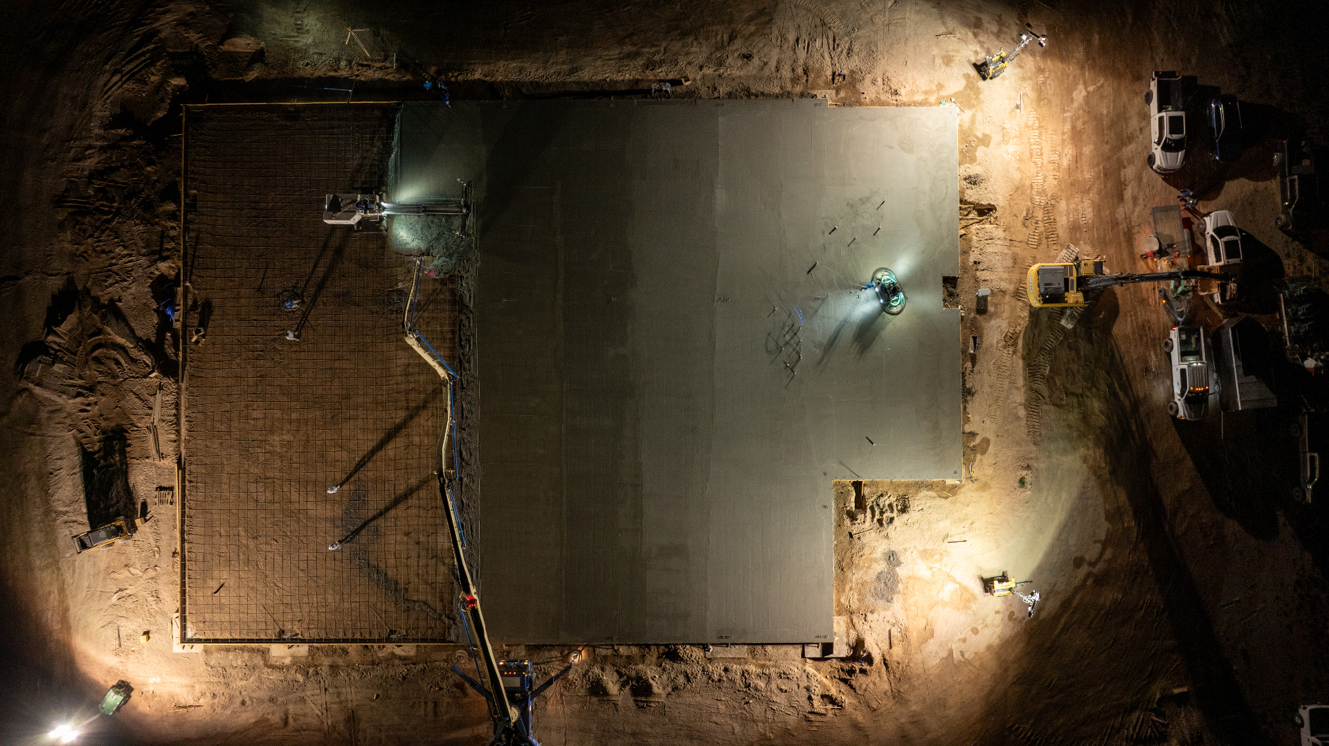
| Foundation & Flatwork | Bi-Weekly | Layout errors caught at this stage are still fixable. Caught after the pour, they're not. |
| Vertical Construction | Monthly | Progress slows visually but documentation still matters — for stakeholders, lenders, and the permanent project record. |
| Punch List & Closeout | Once at Completion | Final as-built documentation for the owner and a permanent project record. |
The Mistake Most People Make
The most common thing I see is a GC or developer who waits until the project is well underway before thinking about aerial documentation. By that point, the grading is done, the utilities are buried, and the foundation is poured. The phases where drone data is most valuable have already passed.
The window for capturing underground utility locations, pre-backfill conditions, and early grading data closes fast — and it never reopens. A flight you skip during earthwork is data that doesn't exist anywhere, not just data you don't have yet.
Starting early — even with a single flight at the beginning of grading — gives you a baseline that every future flight can be compared against. Without that baseline, your later flights lose a significant amount of their analytical value.
What About Budget?
This is the other half of the question, and it's worth addressing directly. Drone documentation is not a fixed cost — it scales with how often you fly and what deliverables you need.
For most Southern Utah construction projects, the right approach is to fly heavily during earthwork and underground phases, then pull back to monthly once the project goes vertical. That structure gives you the highest-value data during the phases where mistakes are most expensive, without overinvesting during phases where monthly visibility is enough.
The way to think about it from a budget standpoint: what's the cost of catching a grading error on a drone flight versus catching it after the asphalt is down? What's the cost of not being able to locate a buried utility line during a repair five years from now? Compared to those costs, consistent aerial documentation is cheap.
You don't have to commit to a full project schedule upfront. Most clients start with one phase, see how the data gets used, and build from there. The important thing is not to start too late.
For Earthwork and Grading Contractors Specifically
If you're running a grading operation, weekly flights during active earthwork aren't optional — they're how you protect yourself. Volume disputes between contractors and suppliers are almost always a he-said-she-said situation without objective data. A 3D surface model from a drone flight gives you the cubic yardage numbers to back up your billing, verify supplier invoices, and show the owner exactly how much has moved and when.
We go deeper on what those 3D deliverables actually look like in our definitive guide to drone 3D modeling deliverables — worth a read before your next grading phase kicks off.
For Developers and Project Owners
Your priority is usually stakeholder reporting and project protection. Monthly flights during vertical construction handle the reporting side well. But the phase most owners underinvest in is the beginning — before the dirt starts moving.
A pre-construction flight establishes your baseline. It documents existing site conditions before any work begins, which protects you if questions come up later about what was there before your crew showed up. It also gives you a starting point for the full project timelapse — something that becomes a serious marketing asset when the project wraps.
The Simple Rule
If something significant is happening on your site this week — dirt is moving, trenches are being dug, concrete is being poured — you should have a flight either this week or next. If the site is in a slower phase, monthly is usually fine.
The question to ask yourself is: if something goes wrong on this site in the next 30 days, do I have a current aerial record that shows exactly what was there and when? If the answer is no, it's time to schedule a flight.
If you're not sure where your project fits or want to talk through what makes sense for your specific phase, reach out to BlueCrest Aerial and we'll work through it with you. No obligation — just a straight answer based on what's actually happening on your site.