If you've heard about drones being used on construction sites but aren't sure what they actually do beyond take pretty pictures from the air, you're not alone. It's one of the most common questions I get. And it's a fair one — because the answer is more practical than most people expect.
Drone services on a construction project aren't about the aircraft. They're about the data that comes off it. Here's what that looks like in the real world.
You Get a Map You Can Actually Measure
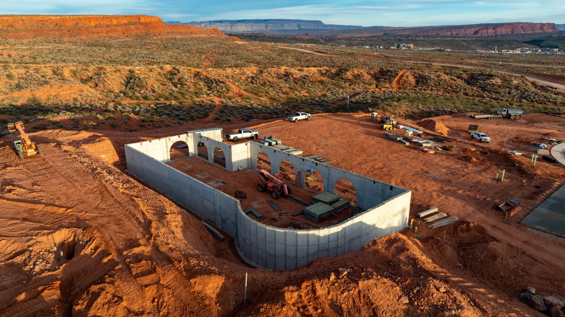
The most fundamental thing a drone can produce for your project is an orthomosaic — a high-resolution, overhead map of your entire site that's been geometrically corrected so that every point on it corresponds to a real location on the ground. It's one of the core deliverables we cover in depth in our guide to drone 3D modeling deliverables for Southern Utah construction.
That means you can open it on your laptop, pull up your civil plans, and overlay them directly on top of what's actually been built. If a utility trench is running two feet off from where it was supposed to go, you'll see it before the pipe is in the ground and the trench is backfilled. That's a very different conversation to have than the one you'd have after the fact.
For GCs managing large sites with multiple trades, that overhead visibility is something you simply can't replicate by walking the ground with a camera.
You Get an Ongoing Record of the Site
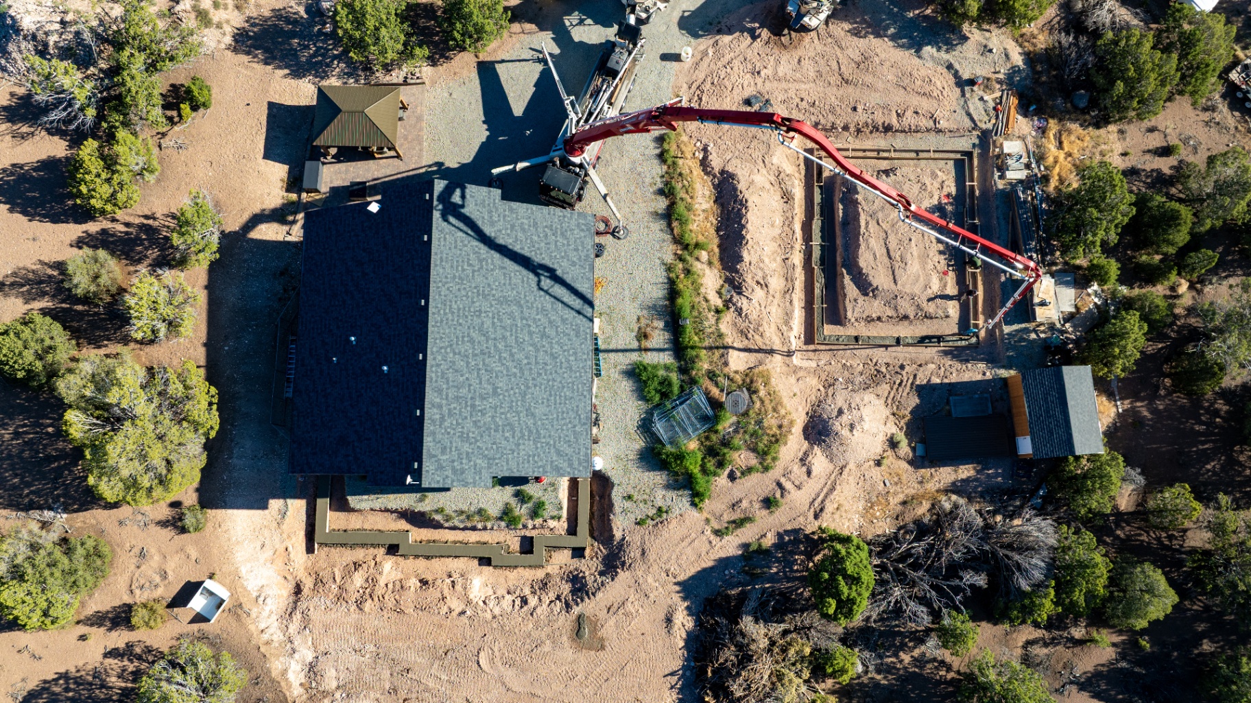
One of the most underutilized benefits of drone services is what happens when you fly consistently — not just once, but at regular intervals throughout the project.
Every flight becomes a timestamped snapshot of the site on that day. Over time, those snapshots stack up into a complete visual history of the build. That record does a few things:
It protects you in disputes.If a subcontractor claims they couldn't access a section of the site on a particular day, or a question comes up about when a certain phase of work was completed, that visual record is the most objective evidence you can have. No one can argue with an aerial photo from that morning.
It keeps owners and lenders informed.For developers with investors or lenders who aren't on-site every week, sending a professional aerial update is a significantly better communication tool than a written status report. People understand what they can see.
It becomes a marketing asset.A project documented from dirt to ribbon-cutting — compiled into a timelapse — is one of the most compelling pieces of content a contractor or developer can put in front of a future client. It shows the scale of what you build in a way that photos and bullet points never will. See how our services work.
You Get 3D Data That Helps Manage Earthwork
If your project involves significant grading, cut-and-fill, or stockpile management, this is where drone services start paying for themselves in a very direct way.
A drone flight processed through photogrammetry software produces a point cloud — a three-dimensional model of your site with elevation data at every point. From that model, you can pull volume calculations on any stockpile on-site, compare how much earth has been moved between flights, and check the site's grade against your design before the asphalt goes down or the landscaping crew shows up. We break down exactly how this works in our full deliverables guide.
Earthwork is often the biggest budget variable on a project. The more visibility you have into what's actually moving — and when — the better position you're in to manage costs, hold subcontractors accountable, and catch problems before they compound.
What It's Not
It's worth being clear about one thing: drone mapping is not a replacement for a licensed surveyor. Property boundaries, legal certifications, and anything requiring a surveyor's seal still requires a licensed surveyor. That's not what this is.
What drone services provide is the high-frequency, between-the-milestones data that keeps a project moving. It's the Monday morning check-in that shows you where the site stands. It's the documentation that covers you if something goes sideways.
It's the data that lets your team make decisions based on what's actually happening on the ground instead of what someone thinks is happening.
How Often Should You Fly?
It depends on the phase. During heavy earthwork, weekly or bi-weekly flights give you the most useful data for tracking progress and keeping dirt counts honest. Once the project moves into vertical construction, monthly flights are usually enough to maintain a solid documentation record for ownership and stakeholders.
The right frequency is the one that gives you useful information at a cost that makes sense for the project. That's a conversation worth having before the first flight, not after. Reach out and we'll help you figure out what makes sense for your site.
Is It Worth It on a Southern Utah Project?
Southern Utah construction sites present some specific challenges that make aerial data more valuable, not less. The terrain is uneven, the earthwork volumes can be significant, and the growth in Cedar City and St. George means projects are moving fast. Decisions that used to have a week of runway now need to be made in a day or two.
If you're flying in the area, it's also worth understanding the local airspace before any drone work begins. We put together a full breakdown of drone airspace restrictions in Southern Utah — national parks, controlled airports, TFRs, and what every site owner should know before hiring a pilot.
Having a clear, current, measurable overhead view of your site isn't a luxury in that environment. It's a practical tool that helps you move faster and make better calls.