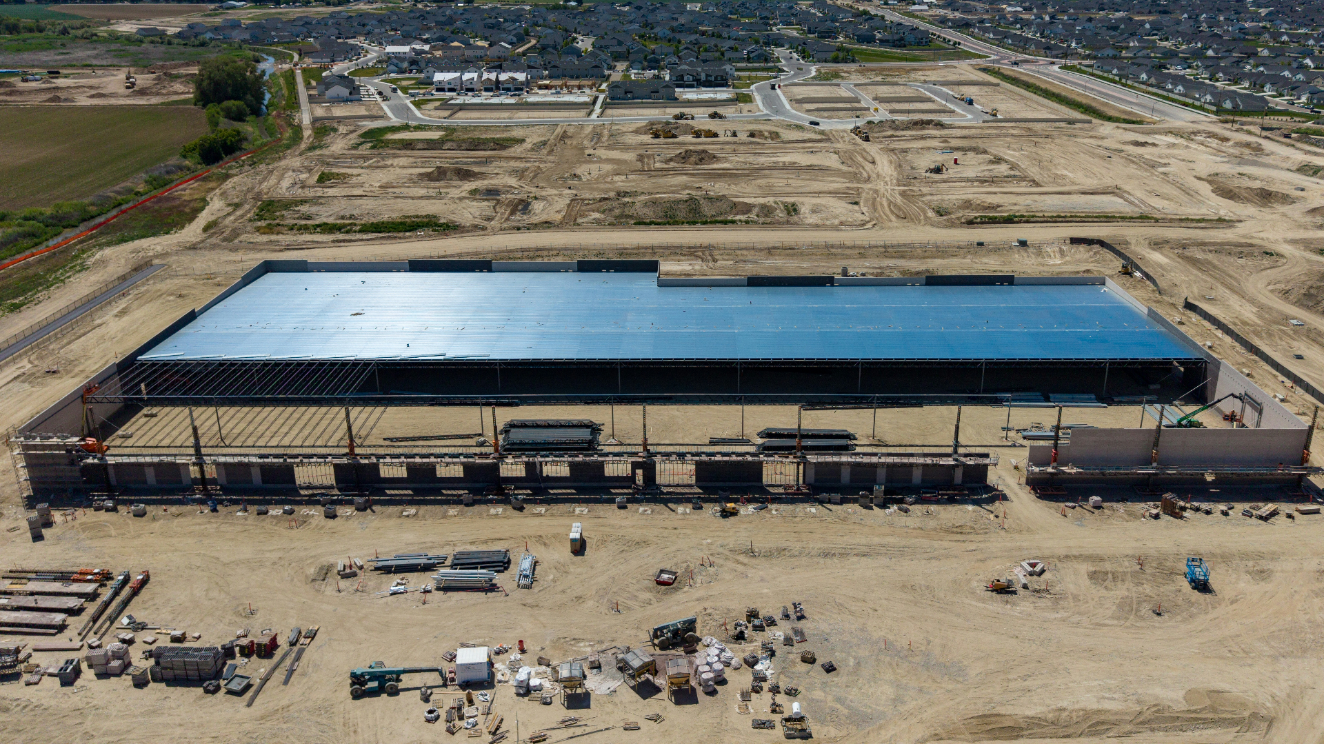
If you work in commercial construction, earthwork, or project management, you are completely surrounded by people trying to sell you the latest and greatest technology. Every week there is a new software, a new gadget, or a new service promising to "transform your workflow."
Drone services are usually right at the top of that list.
But if you are running a dirt crew, managing a tight schedule, or overseeing a large commercial build, you don't have time or money to waste on things that don't move the needle. You have probably seen drone operators pitch their services before — sweeping cinematic videos, high-resolution overhead photos, the whole show. Those aerial media services absolutely have their place. Whether it is a clean overhead shot for a stakeholder presentation, high-end footage for a corporate marketing push, or progress updates to show an owner exactly how the project is moving, professional photography and video are valuable assets. They keep people informed, build trust, and look great.
However, when you move past marketing and basic visual updates, there is a whole separate tier of high-precision, actionable drone data designed to protect your profit margins on the engineering side. The key is knowing exactly what kind of deliverable you need for the problem you are actually trying to solve.
Let's break down exactly which drone services are worth your money, how to match them to your specific goals, and how to spot the difference between basic media and high-precision data.
1. Volumetric Tracking: Stopping the Truck Ticket Bleed
Let's start with the area where earthwork companies lose the most money without even realizing it: material management.
On any major earthwork or excavation job, you are dealing with massive quantities of material — whether it is imported structural fill, exported topsoil, or aggregate base. Traditionally, tracking these quantities relies on a mix of manual surveying and truck tickets.
Relying on truck tickets is a massive gamble. If a supplier tells you they delivered 5,000 cubic yards of material, you are pretty much stuck taking their word for it, counting the trucks as they roll through the gate, and reading the tickets. But bulking factors, partial loads, and simple human error mean that what is on those tickets rarely matches what is actually on the ground.
If you are shorted just 10% on a major material import, that is hundreds or thousands of cubic yards you paid for but never received. By the time you realize the site is short, the trucks are gone, the budget is blown, and you are writing another check just to finish the lift.
How High-Precision Drone Data Fixes This
This is where volumetric drone scanning becomes worth every penny. A drone equipped with high-accuracy sensors flies the site and captures millions of data points across your stockpiles or excavation pits. Specialized photogrammetry software then calculates the exact volume of those piles down to the cubic yard — no guessing, no paper tickets.
- Audit Your Suppliers: When the drone data shows you only have 4,300 yards on the ground but you have been billed for 5,000, you have the hard data you need to call the supplier and fix the invoice.
- Track Daily Production: See exactly how many yards your crews moved from cut to fill in a single day, allowing you to track production rates against your estimate in real-time.
- Bid with Confidence: Knowing your exact inventory means you aren't over-ordering material at the end of a phase just to play it safe.
If you are moving serious dirt, a drone service that provides fast, accurate volumetric tracking pays for itself the first time you catch a major material discrepancy.
2. High-Accuracy Orthomosaics: Grading and Design Verification
A standard overhead photo taken with a basic retail drone is just a picture. If you try to measure a distance or elevation off of it, it will be completely wrong because of camera distortion and a lack of spatial reference. Fine for a quick look at a site — useless for real construction management.
A high-accuracy orthomosaic is a completely different animal. It is a massive image map created by stitching together hundreds or thousands of high-resolution aerial photos. When done right by a professional using proper equipment and real-world ground coordinates, every single pixel in that map contains accurate geographical data.
Catching Mistakes Before They Are Set in Concrete
Think about the cost of a grading mistake. If a sub-grade is off by a tenth of a foot across a large commercial pad, you might not notice it with the naked eye. But when the concrete crew shows up and has to pour extra material to hit finish elevations, that minor grading error turns into a major unexpected bill. Or worse — if the grading causes water to drain toward a building foundation instead of the retention pond, you are looking at a catastrophic rework after the project is already built.
When you invest in routine high-accuracy orthomosaic mapping, you can overlay your actual job-site conditions directly on top of your civil engineering design files.
- Design vs. Reality: Visually and digitally compare actual site conditions against the blueprints. If a utility line is being installed in the wrong spot or a slope is too steep, you catch it immediately.
- Grading Verification: Verify that the earthwork crew hit the exact sub-grade elevations required before handing the site off to the next trade.
- As-Built Documentation: Get a permanent digital record of where everything is located underground before it gets buried. If a dispute arises months down the road about a broken pipe or a misplaced line, you have the photographic proof.
The cost of one grading rework — concrete overages, crew time, schedule delays — can dwarf an entire season of orthomosaic mapping. The data is cheap. The mistake is not.
3. Consistent Progress Updates: The Ultimate Communication Tool
As a general contractor or project manager, half of your job is managing people, expectations, and liability. You are constantly answering to project owners, developers, banks, and inspectors — while simultaneously managing a dozen sub-contractors on-site.
When a project owner calls wanting to know why a phase is running behind, or a bank wants proof of progress before releasing the next draw, sending a guy out with a smartphone to take a few blurry photos from the ground doesn't cut it. It doesn't give a true sense of the site's status.
Eliminating the "He Said, She Said" on the Job Site
Routine drone progress flights provide a comprehensive, bird's-eye view of the entire site on a consistent schedule — whether that is weekly, bi-weekly, or monthly. This creates a verifiable visual timeline of the entire project.
- Streamlined Stakeholder Meetings: Instead of trying to explain site progress with words and spreadsheets, open a high-resolution map of the entire site and walk owners through the exact state of the project in seconds. It builds immediate trust.
- Sub-Contractor Accountability: If a utility contractor claims they couldn't start their work because the earthwork crew hadn't finished clearing an area, you can look back at the weekly drone data to see exactly who was where and when. It eliminates finger-pointing and keeps everyone honest.
- Remote Site Management: If you are managing multiple sites across a region, you can't be everywhere at once. Accurate drone updates let you inspect a site, verify production, and spot safety or logistical issues from your office without driving two hours across the state.
The Catch: Understanding Accuracy Requirements
To get data you can actually base heavy financial decisions on, two things are required: the right conditions and the right methodology.
Lighting Conditions That Matter
When it comes to mapping a job site, lighting is everything — but not in the way most people think. You don't need a perfectly clear, blazing sunny day to get an accurate map. In fact, a flat, overcast sky is often the preferred condition for photogrammetry. Overcast lighting diffuses the sun, eliminating the deep shadows that can hide structural details or confuse the software calculating elevations.
The real deal-breakers are complete darkness, heavy fog, or low visibility that prevents the camera from pulling crisp data. A trained commercial pilot knows how to evaluate site conditions before flying to guarantee the maps delivered are clean, readable, and accurate.
The Myth of "Plug-and-Play" Drone Accuracy
True technical accuracy requires specialized equipment and training. A standard retail drone might tell you it knows where it is based on its internal GPS — but that GPS can be off by several feet. If you try to calculate a stockpile volume or verify a grading elevation with that data, your numbers will be completely useless.
What to look for: Worthwhile drone services utilize high-precision technology like RTK (Real-Time Kinematic) drones and physical ground control points tied into established survey benchmarks. This is the difference between a map accurate to within five feet and a map accurate to within less than an inch. If a drone operator can't explain their accuracy verification process, walk away. You are paying for a toy, not a tool.
The Bottom Line: Are Drone Services Worth It?
If you are looking to showcase your work, secure funding, or keep an off-site owner informed, standard professional aerial photography and progress video are an excellent, high-value investment. They keep the wheels turning and the project looking professional.
But if you are investing in high-precision drone data that delivers:
- Accurate volumetric tracking to stop material delivery shortages and monitor daily dirt movement,
- High-resolution orthomosaic mapping to catch grading errors before they turn into expensive concrete reworks, and
- Consistent engineering-grade progress updates to verify design compliance and protect your schedule,
then the investment becomes a direct line to protecting your profit margins. It provides the practical, on-the-job intelligence that keeps projects on schedule, keeps subs honest, and keeps your profits in your pocket.
Whether you need crystal-clear progress media to keep stakeholders updated or high-precision engineering data to protect your numbers — get the right tool for the job.